


There is a particular quality to walking in Athens that no other European capital quite replicates. The distance between its greatest landmarks is so short that the city feels almost deliberately compressed, as though someone folded the map in half and pressed the centuries together.
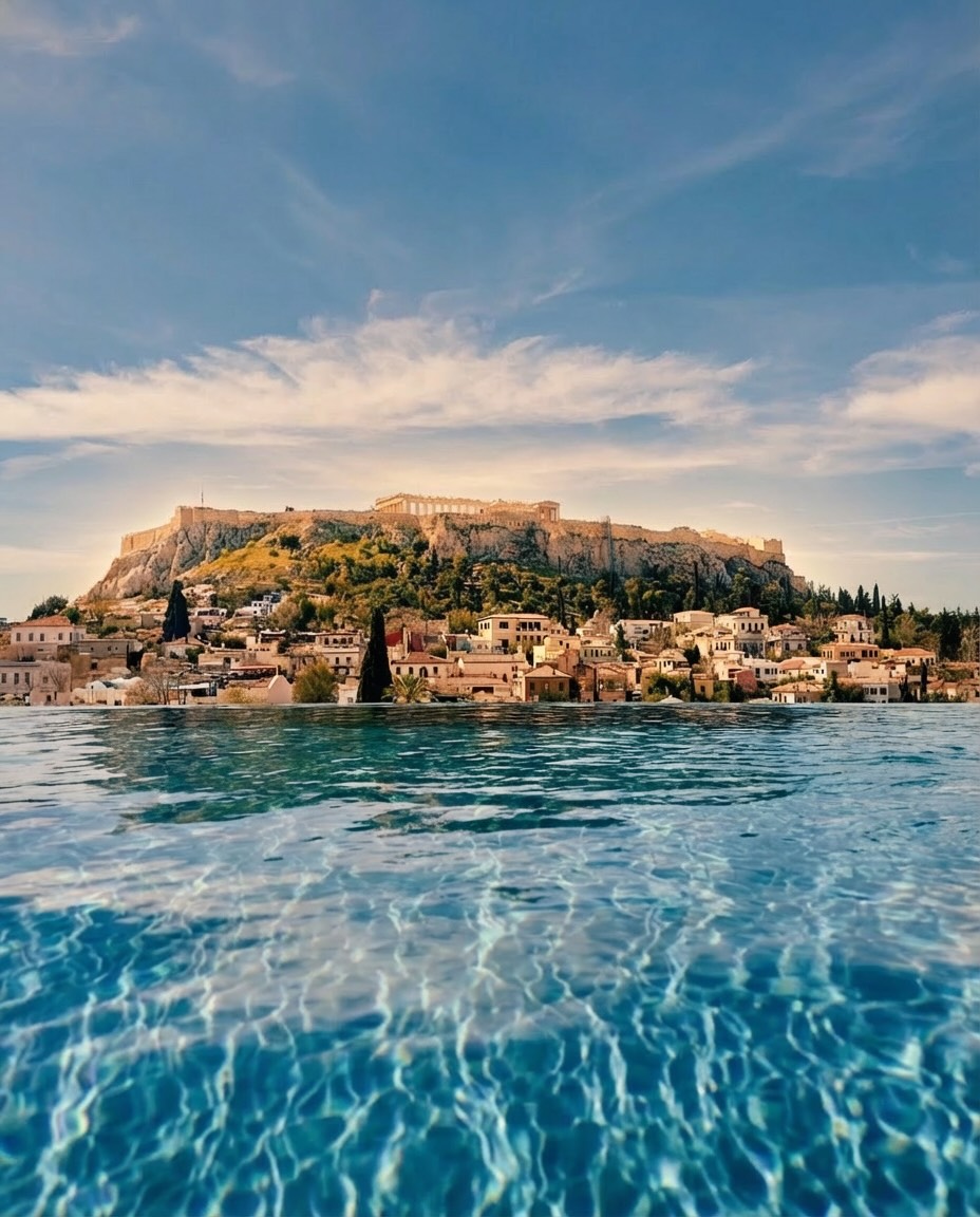
The Parthenon crowns the Acropolis like a thesis statement carved in Pentelic marble, and from its summit the route to the next landmark is already visible below you. A few minutes on foot and you are in the Plaka, the oldest neighborhood in the city, where neoclassical facades and bougainvillea line streets narrow enough that no car could bother you even if it tried.
That is the thing about Athens on foot. The walk itself is the experience. Small-batch natural wine bars and ceramicists’ studios have opened in recent years alongside tavernas that have been there forever, and you encounter all of it not because you planned to but because it fell along a route that barely required a detour. No taxi, no metro transfer, no fifteen-minute bus ride between highlights. Just one landmark leading to the next, with the city filling in the gaps.
The Study
A new study by Radical Storage, which scored the 50 most populous European cities on distance between top attractions, elevation gain, step count and travel time, places Athens in a tie for second, with an index score of 9.8 out of 10. The full route connecting its five most visited landmarks clocks in at just 2.8 kilometers, roughly 5,769 steps, completable in under 45 minutes. The elevation gain is a modest 17 meters, though in July and August, when temperatures hover near 29°C, even modest inclines have a way of making themselves known. Comfortable shoes and a water bottle are non-negotiable.
What makes Athens exceptional in this company is that its walkability is not merely convenient but narratively coherent. The route tells a story, from sacred hilltop to living neighborhood, in a way that a taxi or metro ride would only interrupt. It is the rare major capital where the highlights are not scattered across sprawling districts but concentrated in a dense, almost conspiratorial proximity, as though the city wants to be understood whole.
Athens shares its second-place ranking with Copenhagen, Bergamo and Antwerp, and trails only Milan and Porto, which tied for first.
The Full List
Here is the full top ten, each scored on a ten-point index.
- Milan, Italy, 9.9. From the hushed gravity of Leonardo’s Last Supper at Il Cenacolo to the soaring Gothic nave of the Duomo to the polished 19th-century arcades of Galleria Vittorio Emanuele II, Milan’s route is essentially flat (11 meters of elevation) and takes just 34 minutes. It ends at the canal district of I Navigli, where an aperitivo feels earned even if the walk barely winded you.
- Porto, Portugal, 9.9. The shortest route of any city on the list at 1.9 kilometers, Porto packs its blue-tiled Chapel of Souls, its medieval cathedral, the iron drama of the Luís I Bridge and the café-lined Cais da Ribeira into a 30-minute stroll. The 25 meters of elevation gain hint at Porto’s famously hilly terrain, but the payoff, the Douro River glinting at the finish, is worth the climb.
- Athens, Greece, 9.8. (See above, and go.)
- Copenhagen, Denmark, 9.8. A longer walk at 4.1 kilometers but almost entirely flat, just five meters of elevation, threading from the Ny Carlsberg Glyptotek’s antiquities through Tivoli Gardens, the Torvehallerne food market, Rosenborg Castle and finally the candy-colored waterfront of Nyhavn. Roughly 56 minutes at an easy pace.
- Bergamo, Italy, 9.8. The steeper, more physical entry on the list. Only two kilometers separate the Accademia Carrara from the cobblestoned heights of the Città Alta, but 40 meters of elevation gain, the highest in the top ten, means the funicular exists for good reason. The medieval Piazza Vecchia at the top is among the most beautiful squares in northern Italy.
- Antwerp, Belgium, 9.8. Beginning at the cathedral-like Antwerpen-Centraal station, often called the world’s most beautiful railway terminal, and ending at the lively Grote Markt, the 4.1-kilometer route passes the UNESCO-listed Museum Plantin-Moretus and the riverside MAS museum. Fifty-five minutes, 20 meters of elevation and an overwhelming temptation to stop for frites.
- Nice, France, 9.7. At 4.6 kilometers and just over an hour of walking, Nice’s route hugs the Promenade des Anglais energy without demanding too much of the legs. Sixteen meters of elevation keep things gentle along the Côte d’Azur.
- Amsterdam, Netherlands, 9.7. Four kilometers through the canal-laced center, with 25 meters of elevation gain, most of it, presumably, the incline of bridge steps. Just under an hour to connect the city’s essential landmarks.
- Lille, France, 9.7. Often overlooked in favor of Paris, Lille’s compact Flemish-inflected old town covers 3.6 kilometers in 50 minutes, with 31 meters of elevation and a quiet, unhurried charm.
- Palermo, Italy, 9.7. The third Italian city in the top ten, Palermo’s route stretches 4.9 kilometers through its glorious, crumbling, Arab-Norman layered streets, about an hour and seven minutes of walking and 16 meters of elevation, best undertaken with a granita in hand.
The study was conducted by Radical Storage, which analyzed data across the 50 most populous European cities as of December 2025, scoring each on distance, elevation, step count and estimated travel time between the five most popular attractions. Cities in Russia, Ukraine and Belarus were excluded.