


Despite being located close to Athens, Mount Parnitha offers dozens of trails awaiting discovery for special experiences. The mountain’s summit is at 1,413 metres, but its slopes, covered with pine trees at lower levels and firs higher up, has many trails that are easy to cover, as well as more challenging routes.
Wildfires experienced in 2007 and 2021 have left their marks on the slopes of Mount Parnitha, including at certain popular routes, such as one stretching from the Thrakomakedones region to the Flabouri refuge, which now passes through burnt territory. Numerous other trails offer unbeatable views of the Greek capital as well as the opportunity to walk through densely forested ranges or rocky gorges.
We present 4 trails of varying degree of difficulty and fitness demands.

Trail of Waters
One of the most popular trails at Mount Parnitha, this route begins from the Flabouri refuge and reaches a recreation park at the Mola location. Passing by many springs, hence its name, the Trail of Waters is relatively easy to cover, without any major altitude shifts. The trail begins from the left side of the refuge, leading to the Koromilia spring as its first stop, and continues for the Messiano Nero area, which hosts a kiosk and offers a lovely view of mountain’s eastern side.

From this point, carry on for Mola, an idyllic location with lawn coverage and tall trees. The route is well signposted and takes at least 1 ½ to 2 hours to cover all the way to the Mola location, ideal for a picnic stop at the wooden tables, before returning.

Houni – Bafi
Starting from the cable car’s parking facility and running through the Houni gorge, this trail reaches the Bafi refuge. It ranks as one of the most popular walking routes of the wider Athens area, despite being an uphill walk, starting at an altitude of 492 metres and reaching 1,159 metres. The route’s biggest section runs mostly through the gorge, requiring switches to the left and right sides of the creek. Overall, no challenges will be encountered along this trail, requiring approximately 2 hours for the uphill trek and far less time for the downhill return. Look for an intersecting signposted trail that heads for Flabouri and then Bafi, from where you may opt to return by cable car.
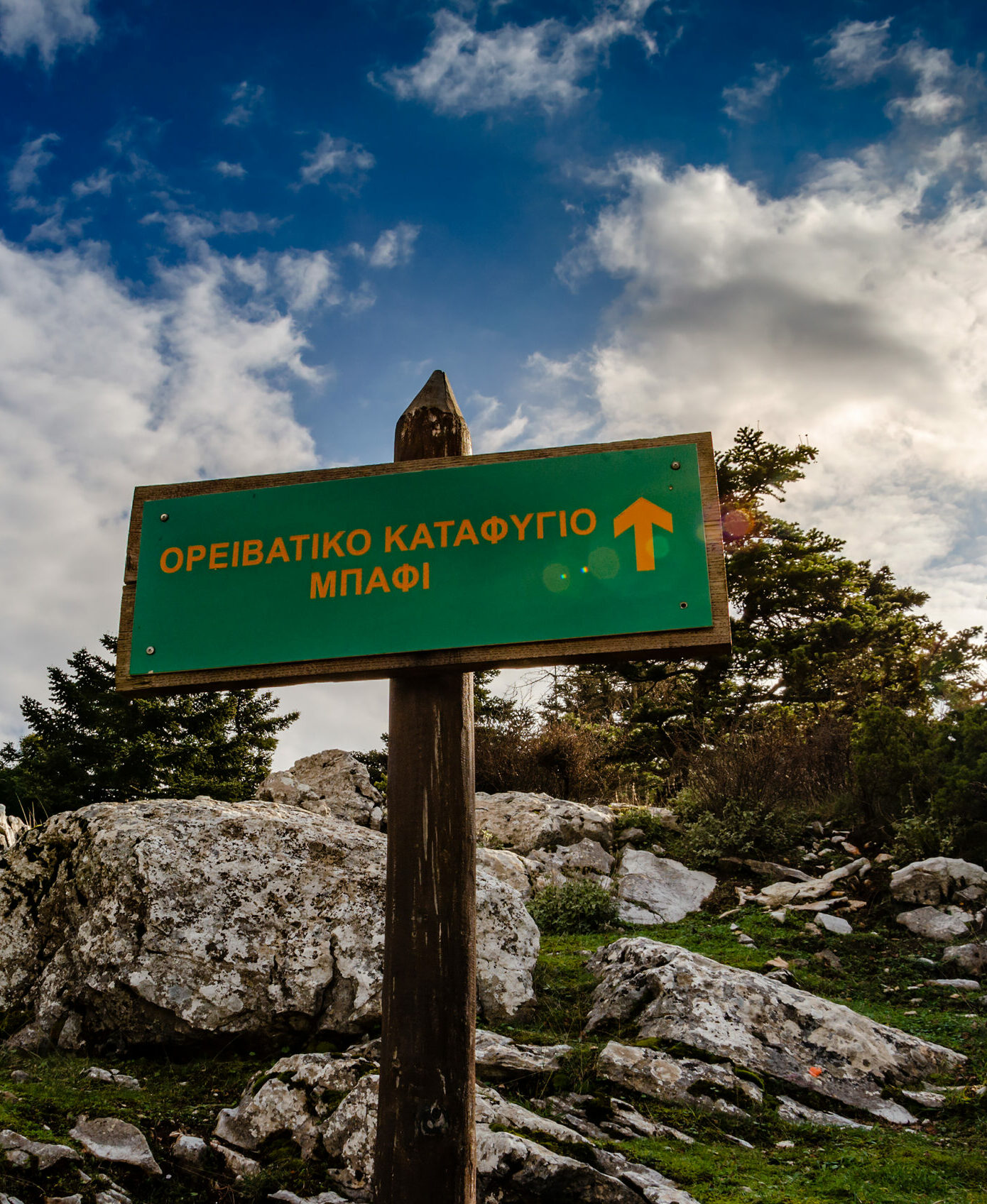
Bafi – Skipiza – Mola – Bafi
A long yet easy-to-cover circular route, this trail essentially goes around the Mount Parnitha summit, Karavola, which cannot be accessed by the public as it hosts a military facility. Leave your vehicle at the Bafi refuge’s parking space and walk back along the tarmac road until you see a signpost to the right indicating the way to the Skipiza spring. Once past the spring, head for the fire lookout station, the Pyrofylakio, built in 1990 by the Forest Protection Volunteers group serving the wider Athens area.
It is situated at an altitude of 1,300 metres, a height offering a unique view of the mountain slopes and beyond. From the fire lookout station, the trail continues, mildly uphill, to the Mola recreation park. From there, return to the route’s starting point, the Bafi refuge. The route runs for approximately 9 kilometres and takes between 3 to 4 hours to cover, depending on your pace and number of stops.
Skalakia
The Skalakia trail is used by many runners and mountain climbers for training as, despite being short, it is steep, hence its name, meaning steps. This trail begins slightly above the cable car’s parking space. A 500-metre dirt track reaches a yellow mark to the right, the starting point of the Skalakia trail.
The trail, covering a total distance of approximately 2,800 metres, virtually covers the same course followed by the cable car, reaching close to the casino. An altitude difference of 560 metres is covered along this steep trail. If wanting to test your uphill endurance, this is a perfect spot.